 Dec 17, 2024
 778
778 0
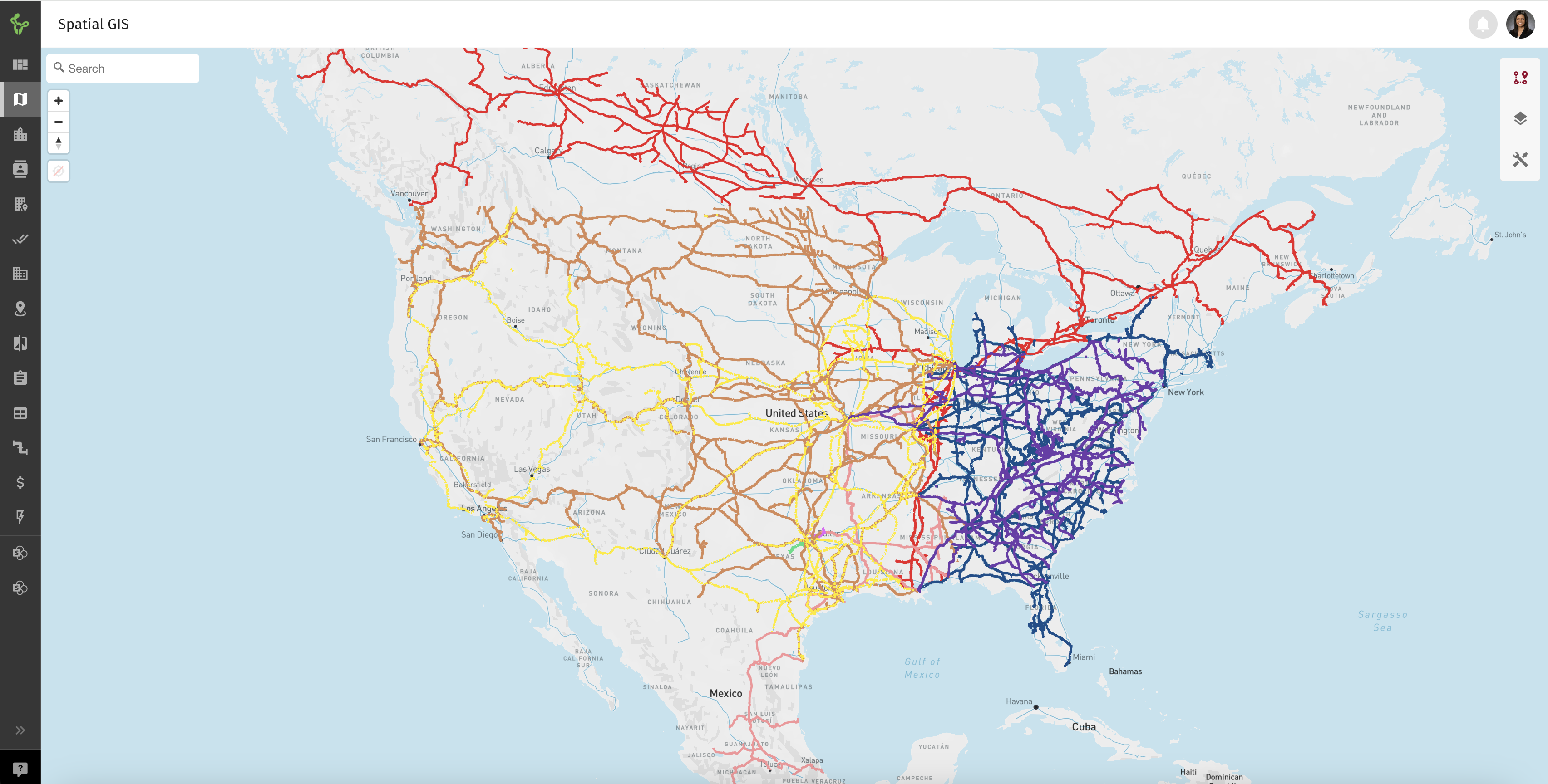
0Knowing the locations of all North American rail lines is crucial for making informed decisions in commercial real estate because rail infrastructure plays a key role in transportation, logistics, and economic development. Using Slick Cactus Spatial GIS mapping, stakeholders can easily visualize and analyze rail networks to identify properties near rail lines that offer significant advantages, such as improved freight access, lower shipping costs, and proximity to major logistics hubs—making them ideal for industrial or warehouse facilities. Rail-connected sites are particularly attractive for businesses that rely on bulk transportation, like manufacturing or distribution centers.
Additionally, understanding the North American rail line locations helps developers and investors assess site accessibility, identify growth corridors, and anticipate areas with high development potential. By aligning real estate investments with strategic transportation networks, stakeholders can maximize property value, improve efficiency, and capitalize on long-term market opportunities.
Leveraging Slick Cactus as your commercial real estate centralized platform for Spatial GIS mapping, CRM, Marketing, and other powerful features gives you a competitive edge and drives better results for your clients.

As CTO Nan is spearheading efforts to elevate the brand awareness of Slick Cactus within the commercial real estate industry.